
Wilmette ZIP Directory Coverage
Official Village, library, and postal anchors confirm 60091 for Wilmette municipal addresses. Village Hall and Wilmette Public Library both use it, as does the Wilmette Post Office. Nearby 60093 belongs to the postal geography of Winnetka and Northfield in the inspected official sources. It is useful as an edge check, but those sources did not establish it as a Wilmette municipal ZIP.
| ZIP Code | Areas Covered | Post Office | Notes |
|---|---|---|---|
| 60091 | Verified Wilmette municipal addresses | Wilmette Post Office, 1241 Central Avenue, 847-251-6039 | Station address is 60091-2571; verify each street and unit |
| 60093 | Winnetka and Northfield in inspected official sources | Winnetka Post Office, 586 Lincoln Avenue | Adjacent comparison, not established as a Wilmette municipal ZIP |
The careful conclusion is narrow: 60091 is the verified Wilmette ZIP code. No official downloadable USPS boundary polygon or address-by-address edge list was found in the research. That gap does not justify adding 60093 to Wilmette. It means an address near the north or west edge should be checked at the street level with USPS and the Village or county map.
USPS Checks for Wilmette ZIPs
The USPS ZIP Code Lookup offers three distinct searches. “By Address” takes a required street address, optional company and unit, plus city, state, and optional ZIP. “By City and State” returns ZIPs associated with a postal locality. “Cities by ZIP Code” reverses the check and returns city names tied to a supplied ZIP.
| USPS mode | Required key | Best Wilmette use |
|---|---|---|
| By Address | Street address | Standardize a full civic address and obtain ZIP or ZIP+4 |
| By City and State | City and state | Check ZIPs associated with the Wilmette postal locality |
| Cities by ZIP Code | ZIP code | See the city names USPS associates with 60091 or a nearby ZIP |
USPS warns that a ZIP result does not confirm a person or business at the address. If more than one address matches, add the unit or narrow the street line. After local government assigns a new address, USPS says to allow five to seven business days before checking.
60091 Beside 60093
The contrast between the Wilmette station at 60091-2571 and the Winnetka station at 60093-9700 makes the local boundary issue concrete. ZIPs route mail. Village limits govern municipal services and records. A short drive between post offices can cross both kinds of line, but neither station address maps every parcel at the edge.
The Census QuickFacts profile for Wilmette is the successful image assigned to this ZIP page.
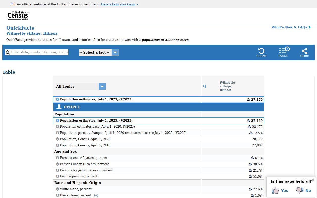
The profile reports Village geography, not USPS delivery limits. That difference is why a ZIP code directory should pair census or municipal context with address-level postal verification.
Find Wilmette Residents by ZIP
Only some official tools accept ZIP, and each returns a different kind of match. The Illinois voter form requires ZIP during a one-person verification. The Cook County Property Tax Portal accepts ZIP as an optional part of an address search. I-CASH uses city and ZIP only to narrow a name-first unclaimed-property query. None is an open list of all people in 60091.
- Standardize the complete address in USPS. Record the city label, five-digit ZIP, ZIP+4, and unit as returned.
- Choose an official source that accepts ZIP. Use the tax portal for an address and PIN, or the voter tool for a supplied person's identity check.
- Compare the street and parcel in Village mapping or CookViewer. A ZIP result alone does not establish the municipal side of the line.
- Once a specific street is known, use the Wilmette streets lookup for address-keyed records rather than treating the whole ZIP as one roster.
Keep the search result tied to its scope. A voter match confirms the submitted combination. A tax result identifies a parcel and tax account. An I-CASH result is a claim lead that still needs identity and relationship proof.
Wilmette ZIP Search Fields
The portal comparison prevents a common error: promising ZIP-wide results from a system that has no ZIP mode. Cook County's Assessor search uses address, PIN, township, neighborhood, and related parcel fields. CookViewer searches address, PIN, intersection, or map selection. The Clerk's Recordings System uses names, PIN, legal descriptions, document types, and dates. Those tools become useful after a ZIP search has produced a street address or parcel key.
| Portal | ZIP field | Actual output |
|---|---|---|
| Illinois voter lookup | Required five digits | One-person match, then street confirmation |
| Cook County Property Tax Portal | Optional in address mode | Property and PIN tax result |
| Assessor and CookViewer | No inspected ZIP mode | Address, PIN, neighborhood, intersection, or map results |
| Clerk's Recordings System | No ZIP mode | Document index by party, PIN, address, legal description, type, or date |
| I-CASH | Optional narrowing field | Name-first unclaimed-property matches |
Note: Bulk voter data has eligibility, fee, redaction, and purpose limits; the public individual form is not a route to browse every 60091 address.
From Wilmette ZIP to Parcel
A Cook County PIN is a 14-digit parcel key, often displayed in five dashed groups such as 17-09-461-015-0000. The Assessor expects a 14-digit PIN. The Clerk's recording search accepts dashed or undashed forms, and its legal-description tools use other land keys. A PIN can change after a parcel is split or combined, so missing tax years may point to parcel lineage rather than a missing address.
Postal address, property location, legal description, and mailing address are separate fields. The Assessor's property-location label is not a legal or postal promise. A mailing address can sit outside Wilmette even when the parcel is within the Village. Use the CookViewer parcel map to connect the point on the map to the PIN, then use USPS for the postal line.
Before Wilmette ZIP Code Indexing
Modern ZIP codes are poor keys for much of Wilmette's older record trail. Wilmette incorporated in 1872. Gross Point, west of Ridge Road, was annexed in 1924 and 1926. No Man's Land near Lake Michigan and Kenilworth joined in 1942. Older records may use those place names even where a modern address now uses Wilmette and 60091.
The Wilmette Public Library map inventory includes early plats, annexations, the Ouilmette reservation and subdivisions, and New Trier Township maps. Reverse directories and telephone books provide the address-to-name layer for years when ZIP was absent or not an index field. No verified comprehensive street-renumbering year was found, so an old number should be checked against maps, cross streets, legal description, directory year, and parcel geometry.
Wilmette ZIP Geography Clues
Local development names can help place an address when a postal search is too broad. Indian Hill Estates was platted in 1926, and Village history identifies Mohawk, Iroquois, and Blackhawk among its streets. The rail corridor near Wilmette Avenue and Green Bay Road grew around the early Chicago and North Shore stop, while CTA service reached the Village in 1912. Ridge Road, Sheridan Road, Green Bay Road, Metra, and CTA remain useful anchors when an old source gives a cross street but no modern ZIP.
These labels do not create separate postal zones. They help reconcile an address across eras. A reference to Gross Point may lead west of Ridge Road, while a No Man's Land reference points toward the lakefront and Kenilworth edge. Once the likely area is known, compare the old map with current parcel geometry, then check the modern street line through USPS. This sequence avoids forcing a historical place name into the present 60091 label before the address itself has been matched.
The Village's Map and Data Portal adds municipal map context, while the county viewer supplies parcels and PINs. Neither map was found to offer a public ZIP-wide resident browse. Use them to confirm where a point sits, not to infer every person associated with the postal area.
Wilmette Address Records Beyond ZIP
A postal match can lead to several address-based records that answer questions a ZIP cannot. Wilmette Community Development keeps building permits from 1920 to the present, according to the library's house-history material. Permits and certificates of occupancy can be requested by address. Village zoning, land-use maps, and historic-preservation inventories add parcel and street context. Public school, park, and election district maps may add another boundary layer, though no single official Wilmette school-attendance ZIP finder was located.
Choose the access channel that matches the record. Start with the Community Development office for permit and occupancy files. Use the Village map portal for public layers. If an identified municipal file is not posted, send a focused Illinois Freedom of Information Act request with the full street address, record type, and date range. The ordinary response period is generally five business days, subject to the law's extension and special-request rules.
Historical address work has a different fallback. The Wilmette Public Library and Wilmette History Museum hold reverse directories, ownership indexes, maps, and house files that can connect a street to a name before ZIP codes became useful. A directory entry remains evidence for its printed year only. Pair it with a deed, permit, obituary, or census record when tracing a household. For current postal form, return to USPS at the end and keep the historical and modern labels distinct.
Wilmette ZIP and Village Limits
A postal city and ZIP route mail, while Wilmette's corporate boundary determines whether Village records apply. A 60091 mailing line is strong postal evidence, but it does not prove the parcel is within today's municipal boundary. The reverse also matters: an address that carries a nearby postal-city label should not be discarded until its parcel and Village status are checked.
- ZIP vs ZIP+4
- A five-digit ZIP identifies a delivery area. ZIP+4 narrows that route to a smaller group, building, or delivery segment.
- PO-box ZIP
- A ZIP used for post-office boxes rather than ordinary street delivery. None was confirmed as a separate Wilmette ZIP in the inspected sources.
- Unique ZIP
- A postal code assigned to one high-volume organization. No unique Wilmette ZIP was established in the research.
- Carrier route
- A set of addresses served by one postal delivery route, which need not match a Village or neighborhood line.
Boundary check. Verify the postal line with USPS, the parcel with CookViewer, and the municipal source with the Village before drawing a geographic conclusion.